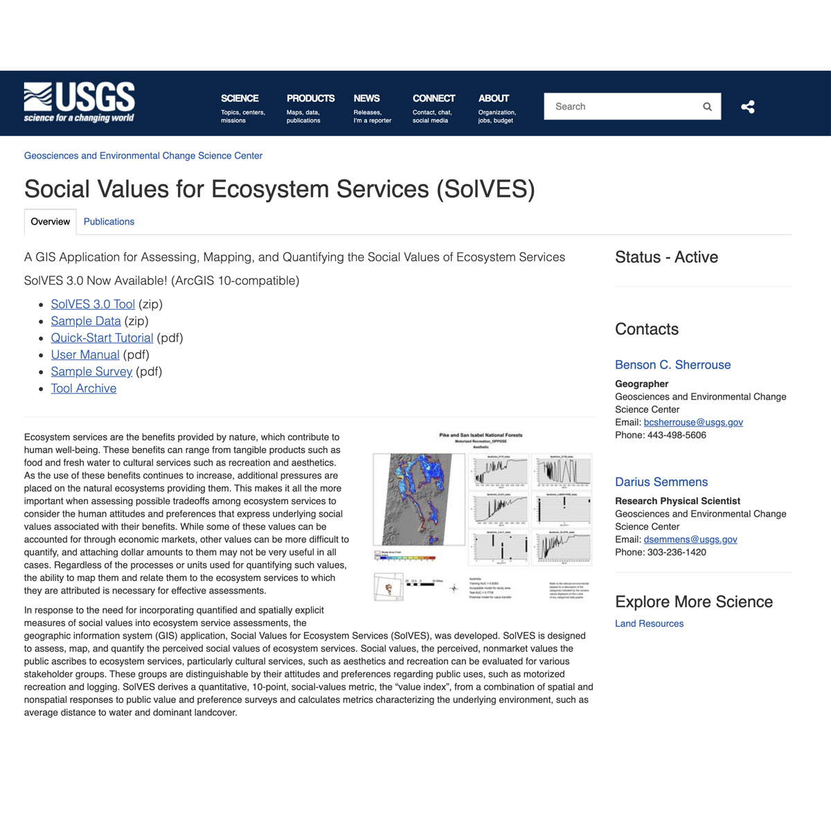
Social Values for Ecosystem Services, Version 3.0 (SolVES 3.0) is a geographic information system (GIS) application developed by the USGS Geosciences and Environmental Change Science Center (GECSC). SolVES incorporates quantified and spatially explicit social-values information into ecosystem service assessments. Social values are defined here as t ...
DOI: 10.3133/ofr20151008
DOI: 10.1016/j.ecolind.2013.07.008
DOI: 10.3133/fs20123125
Last Update: 2015
Data analysis Ecosystem function Ecosystem services
Login to add the tool into your favorites.
Social Values for Ecosystem Services, Version 3.0 (SolVES 3.0) is a geographic information system (GIS) application developed by the USGS Geosciences and Environmental Change Science Center (GECSC). SolVES incorporates quantified and spatially explicit social-values information into ecosystem service assessments. Social values are defined here as the perceived, nonmarket values the public ascribes to ecosystem services, particularly cultural services, such as aesthetics and recreation. SolVES 3.0 provides functionality to assess, map, and quantify social values such as aesthetics, biodiversity, and recreation by deriving social-value maps rendered as a 10-point value index (ranging from 0 to 10) from a combination of spatial and nonspatial responses to public value and preference surveys. SolVES 3.0 also calculates metrics characterizing the underlying environment, such as average distance to water and dominant landcover. Through its integration with Maxent maximum entropy modeling software, SolVES 3.0 can generate more complete social-value maps and offer statistical models describing the relationship between the value index and explanatory environmental variables. SolVES 3.0 provides an improved public-domain tool for decision makers and researchers to evaluate the social values of ecosystem services and to facilitate discussions among diverse stakeholders regarding the tradeoffs among ecosystem services in a variety of physical and social contexts ranging from forest and rangeland to coastal and marine. Outputs: maps & graphs
Monitoring program(s) or initiative(s) using the tool:
Although this software program has been used by the U.S. Geological Survey (USGS), no warranty, expressed or implied, is made by the USGS or the U.S. Government as to the accuracy and functioning of the program and related program material nor shall the fact of distribution constitute any such warranty, and no responsibility is assumed by the USGS in connection therewith.
| Contact person: | Benson C. Sherrouse |
|---|---|
| Contact e-mail: | bcsherrouse@usgs.gov |
| Contact Organization: | USGS, Geosciences and Environmental Change Science Center |
| License: | Free, SolVES 3.0 requires ArcGIS 10 software |
| Technical Status: | Finish and with constant technical support |
| URL(s): |
https://solves.cr.usgs.gov
https://gec.cr.usgs.gov/solves/downloads/SolVES_V3_QuickStart.pdf https://pubs.usgs.gov/of/2015/1008/pdf/ofr2015-1008.pdf |
Login to add a review for the tool Social Values for Ecosystem Services (SolVES)