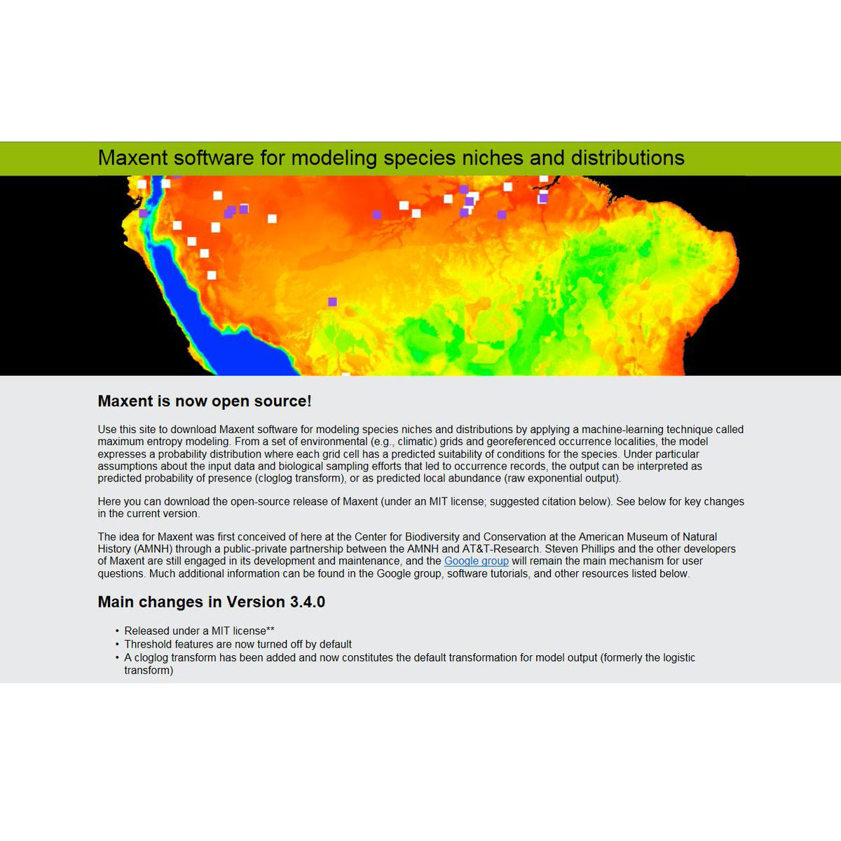
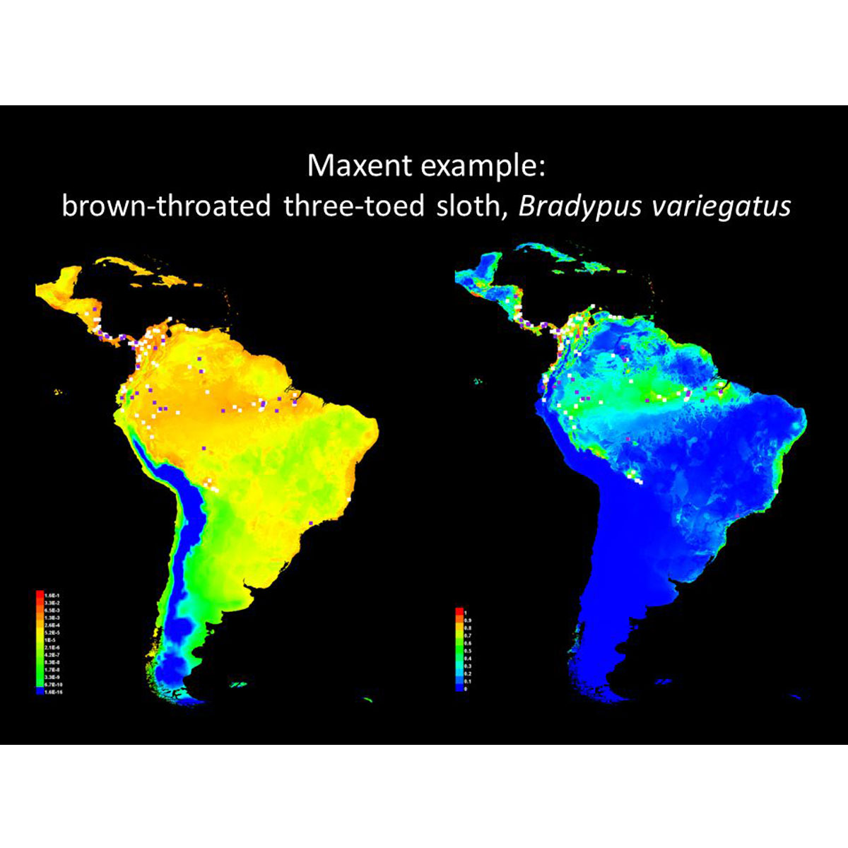
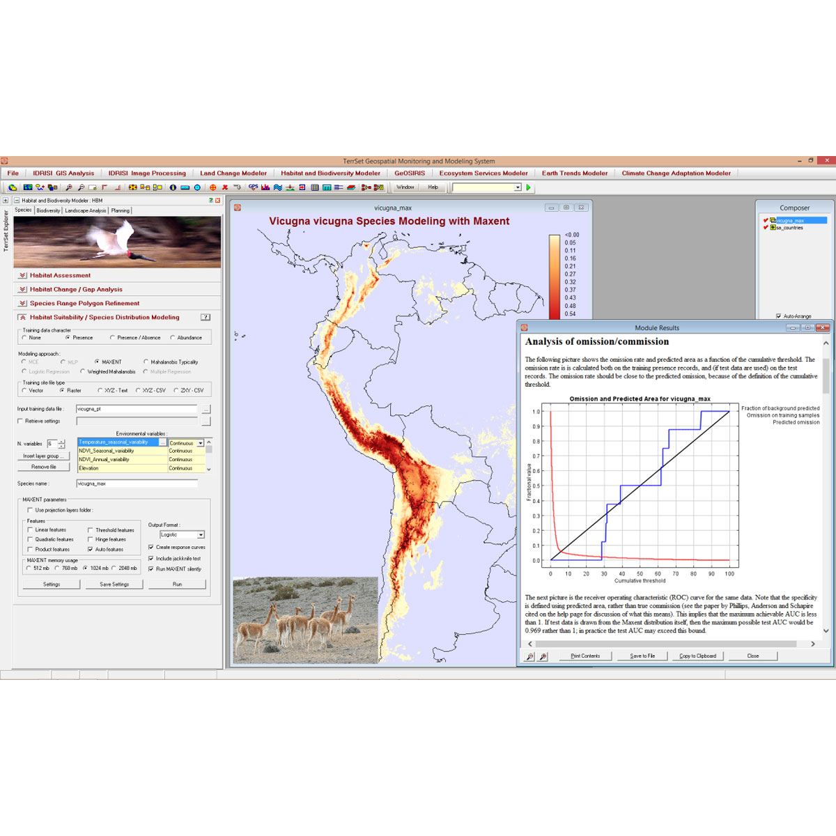
The Maxent software is based on the maximum-entropy approach for species habitat modeling. This software takes as input a set of layers or environmental variables (such as elevation, precipitation, etc.), as well as a set of georeferenced occurrence locations, and produces a model of the range of the given species. Maxent is a Java-based applicatio ...
DOI: 10.1111/ecog.03049
DOI: 10.1016/j.ecolmodel.2005.03.026
DOI: 10.1111/j.1472-4642.2010.00725.x
Last Update: 2016
Data analysis Species populations Plants Mammals Reptiles Butterflies Other Invertebrates Birds Fishes Amphibians Macroinvertebrates
Login to add the tool into your favorites.
The Maxent software is based on the maximum-entropy approach for species habitat modeling. This software takes as input a set of layers or environmental variables (such as elevation, precipitation, etc.), as well as a set of georeferenced occurrence locations, and produces a model of the range of the given species. Maxent is a Java-based application and can be used on any computer running Java version 1.5 or later. The model for a species is determined from a set of environmental or climate layers (or "coverages") for a set of grid cells in a landscape, together with a set of sample locations where the species has been observed. The model expresses the suitability of each grid cell as a function of the environmental variables at that grid cell. A high value of the function at a particular grid cell indicates that the grid cell is predicted to have suitable conditions for that species. The computed model is a probability distribution over all the grid cells. The distribution chosen is the one that has maximum entropy subject to some constraints: it must have the same expectation for each feature (derived from the environmental layers) as the average over sample locations.
| Contact person: | Steven J. Phillips |
|---|---|
| Contact e-mail: | mrmaxent@gmail.com |
| Contact Organization: | Center for Biodiversity and Conservation, American Museum of Natural History |
| License: | MIT License (MIT) |
| Technical Status: | Finish and with constant technical support |
| URL(s): |
https://biodiversityinformatics.amnh.org/open_source/maxent
https://github.com/mrmaxent/Maxent https://biodiversityinformatics.amnh.org/open_source/maxent/Maxent_tutorial2017.pdf |
 Mar 2020
Awesome tool, which was used as well for the article: https://doi.org/10.1038/s41586-020-2138-7 published in nature.
Login to add a review for the tool Maxent
TOOLS YOU MAY ALSO LIKE