 © Map of Life (MOL)
 © Map of Life (MOL)
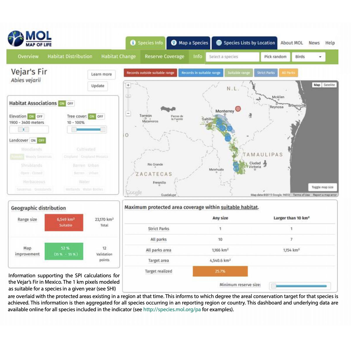
The Species Protection Index (SPI) measures how much suitable habitat for single species is under protection and estimates the regional or global biodiversity representativeness of terrestrial protected areas. The index uses environmental and species data addressing all terrestrial areas of the world at 1km spatial resolution. It can be aggregated ...
DOI: 10.978.39817938/19
Last Update: 2015
Data reporting Species populations Terrestrial Mammals Reptiles Birds Amphibians
Login to add the tool into your favorites.
The Species Protection Index (SPI) measures how much suitable habitat for single species is under protection and estimates the regional or global biodiversity representativeness of terrestrial protected areas. The index uses environmental and species data addressing all terrestrial areas of the world at 1km spatial resolution. It can be aggregated at spatial levels ranging from 1km to small regions, countries, biomes, and the whole planet. The index uses land cover information available annually from Landsat and MODIS satellites since 2001 onwards. With continuation of these remote sensing products, this enables annual index updates, including reporting Aichi arget 11 achievements, for ten data points from 2011 to 2020.
| Contact person: | Walter Jetz |
|---|---|
| Contact e-mail: | walter.jetz@yale.edu |
| Contact Organization: | Yale University |
| URL(s): |
https://species.mol.org/pa
https://www.geobon.org/downloads/biodiversity-monitoring/technical-reports/GEOBON/2015/GBCI-Version1.2-low.pdf |
Login to add a review for the tool Species Protection Index
TOOLS YOU MAY ALSO LIKE


 © Cornell Lab of Ornithology