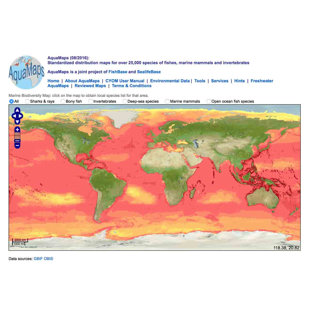
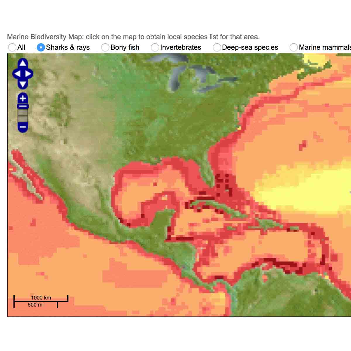
AquaMaps is an approach to generating model-based, large-scale predictions of currently known natural occurrence of marine species. Models are constructed from estimates of the environmental tolerance of a given species with respect to depth, salinity, temperature, primary productivity, and its association with sea ice or coastal areas. Maps show t ...
Last Update: 2016
Data analysis Species populations Marine Freshwater
Login to add the tool into your favorites.
AquaMaps is an approach to generating model-based, large-scale predictions of currently known natural occurrence of marine species. Models are constructed from estimates of the environmental tolerance of a given species with respect to depth, salinity, temperature, primary productivity, and its association with sea ice or coastal areas. Maps show the color-coded relative likelihood of a species to occur in a global grid of half-degree latitude / longitude cell dimensions, which corresponds to a side length of about 50 km near the equator. Predictions are generated by matching habitat usage of species, termed environmental envelopes, against local environmental conditions to determine the relative suitability of specific geographic areas for a given species. Knowledge of species' distributions within FAO areas or bounding boxes is also used to exclude potentially suitable habitat in which the species is not known to occur.
| Contact person: | Kristin Kaschner |
|---|---|
| Contact e-mail: | kristin.kaschner@biologie.uni-freiburg.de |
| Contact Organization: | University of Freiburg |
| URL(s): | http://aquamaps.org |
Login to add a review for the tool AquaMaps
TOOLS YOU MAY ALSO LIKE