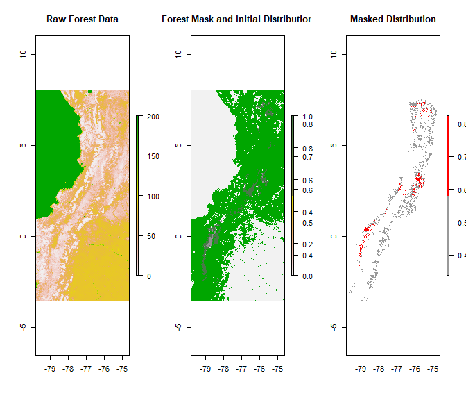
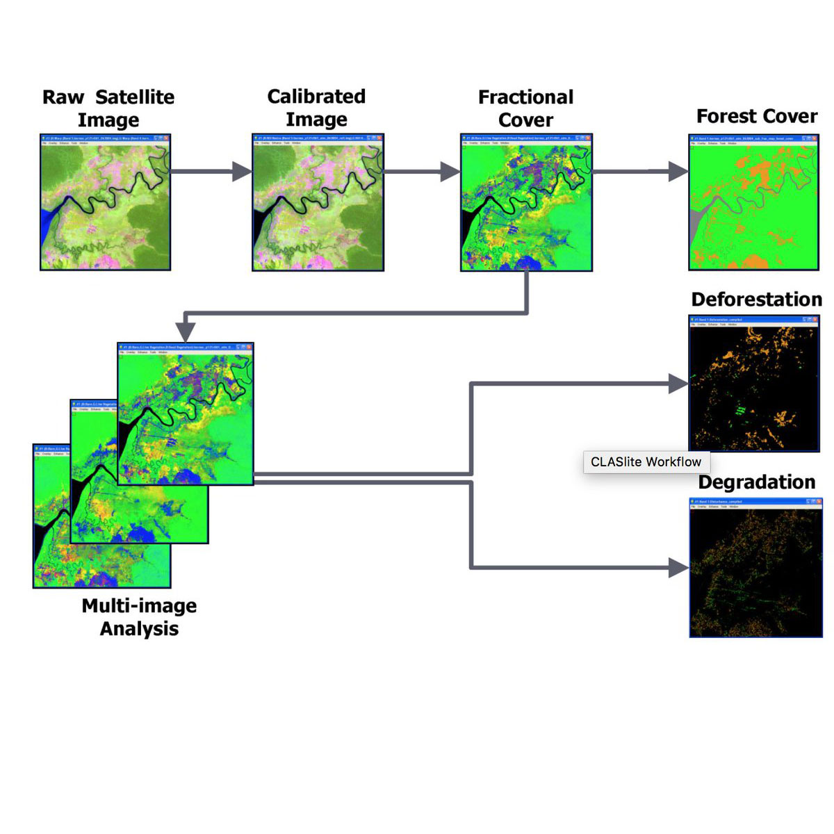
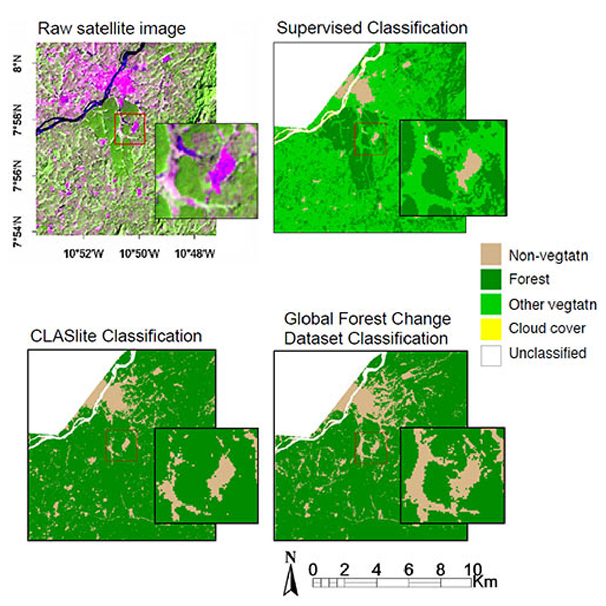
The Carnegie Landsat Analysis System - Lite (CLASlite) is a highly automated system for converting satellite imagery from its original (raw) format, through calibration, pre-processing, atmospheric correction, and cloud masking steps, Monte Carlo Spectral Mixture Analysis, and expert classification to derive high-resolution output images. A softwar ...
DOI: 10.1186/s13021-015-0015-8
Last Update: 2014
Data analysis Ecosystem structure Terrestrial Plants
Login to add the tool into your favorites.
The Carnegie Landsat Analysis System - Lite (CLASlite) is a highly automated system for converting satellite imagery from its original (raw) format, through calibration, pre-processing, atmospheric correction, and cloud masking steps, Monte Carlo Spectral Mixture Analysis, and expert classification to derive high-resolution output images. A software package designed for identification of deforestation and forest degradation from remotely sensed satellite imagery. Developed by Greg Asner and his team at the Carnegie Institution, CLASlite incorporates state-of-the-art research in remote sensing into a simple, user-friendly yet powerful tool for non-profit institutions and governments in need of technologies for forest monitoring and environmental planning. CLASlite currently analyses imagery from the Landsat 4 and 5 TM, Landsat 7 ETM+, Terra-MODIS, Aqua-MODIS, Terra-ASTER, EO-1 Advanced Land Imager (ALI), SPOT-4, and SPOT-5 satellite sensors. CLASlite will fully support Landsat 8 (LDCM) imagery after its launch in January 2013.
| Contact person: | Gregory Asner |
|---|---|
| Contact e-mail: | gpa@carnegiescience.edu |
| Contact Organization: | Carnegie Institution for Science |
| URL(s): |
https://carnegiescience.edu/news/forest-monitoring-bringing-power-people
https://www.youtube.com/watch?v=NZleSls1Xwk |
Login to add a review for the tool CLASlite
TOOLS YOU MAY ALSO LIKE